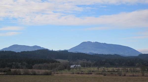
Located in the Siuslaw National Forest of Oregon, Marys Peak stands out as the highest peak in the Oregon Coast Range at 4097 ft (1249 m). Though not as profoundly tall as some mountains, the view west from the towns of Corvallis and Philomath are marked by the distinctive shape of the peak and is also the highest point in Benton County.
The Kalapuya people were the earliest inhabitors and lived off hunting and foraging in the streams and woods. During the 20th century, the community of peak consisted of a post office, cedar shingle mill and dual purpose building for a school and a church. By 1905 a single room school house was constructed and young single teachers were hired to come and board with a local family, rarely returning for a second year. Farming was found to be difficult due to steep terrain and short growing season, turning instead to raising livestock.At the summit a fire lookout and radar installation were erected. The settlement as well as the towns of Corvallis and Philomath, were supported by the streams flowing from the peak by means of a gravity water system made of redwood pipes. The road to the summit, Marys Peak Road, was constructed by 37 members of the Camp Nestucca Civilian Conservation Corps. At the start of the 21st century, the homesteads that remained were purchased by logging companies. The peak was surrounded by national forest and was shortly incorporated into this land. The Marys Peak watershed is today known as the Rock Creek Municipal Watershed and includes approximately 10,000 acres that are jointly owned by the city of Corvallis and the United Stated Forest Service.
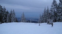
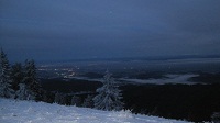
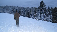
In the early 20th century, the peak was noted as one of the best areas for winter recreation in the west outside of Mount Hood, even posessing a portable ski tow and skit hut. Currently, the woods surrounding and leading up to the peak are prized hiking areas with several trails winding through the different plant communities present. There is also a campground located near milepost 5.
The name of the peak is of uncertain origin, leaning toward the theory of being named after the Marys River that runs just north of the mountain. Other names include the Native American version of Chinitmini and Mouse Moutain.
www.bentoncountymuseum.org
www.ohwy.com
www.usfs.gov
www.traveloregon.com